Denali and Begguya
After two years working with the Denali water isotope record, I was finally able to visit the drill site in person. Our small team of three University of Maine PhD students and myself (an undergraduate at Dartmouth at that point) spent the year working on proposals, grants, and permit requests. By spring, we had permission from the Park Service to work in Denali National Park, commitment of helicopter and ski plane support, $30,000 in funding (all from small grants), and a plan for an incredible month of fieldwork.
Our team met for a crazy two days in Anchorage buying food and assembling gear. A quick shuttle got us to Talkeetna, and the incredible team at Talkeetna Air Taxi had our ski plane, loaded with gear, sitting at the Denali base camp on the Kahiltna glacier the very next day.
Our first goal was to acclimate. After a night at base camp, and burying the bulk of our food, we geared up for a lap on Denali’s West Buttress. This famous climbing route is the main path up Denali, North America’s highest mountain. We started from basecamp at ~7000’. Two days on the route got us up to Camp 2 at 11,000’. We traveled at night, as the warm June days softened the snow surface and increased the crevasse hazard. After three nights at 11,000’ we felt strong and ready for the next phase of our trip. It took us two days to ski back to base camp. We used this journey to collect our first scientific data of the trip.
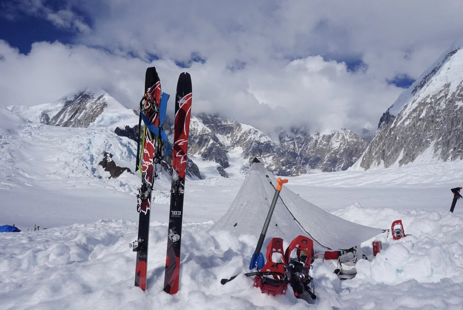
Camp 1 on Denali’s West Buttress, with my skis and harness sitting in front of our cook tent. Denali, shrouded in cloud, sits behind.
We had two goals on our descent of the Kahiltna Glacier. The first was to repeat a VHF survey down the Kahiltna glacier, first completed a decade earlier. Doing this allows us to compare the two surveys and to see changes to the snow and firn layers. (“Firn” is a word scientists use to describe snow on a glacier that’s over a year old. It’s still snow-like, but it’s on its way to being compacted into ice deeper down in the glacier). Our second goal was to collect snow surface samples, to undergo water isotope measurements. The ice core on Begguya contains a great high-resolution water isotope record, which I’ve been studying. My idea with these water isotope samples was to collect samples at a variety of heights on Denali, to understand what effect elevation may play in driving the isotope record.
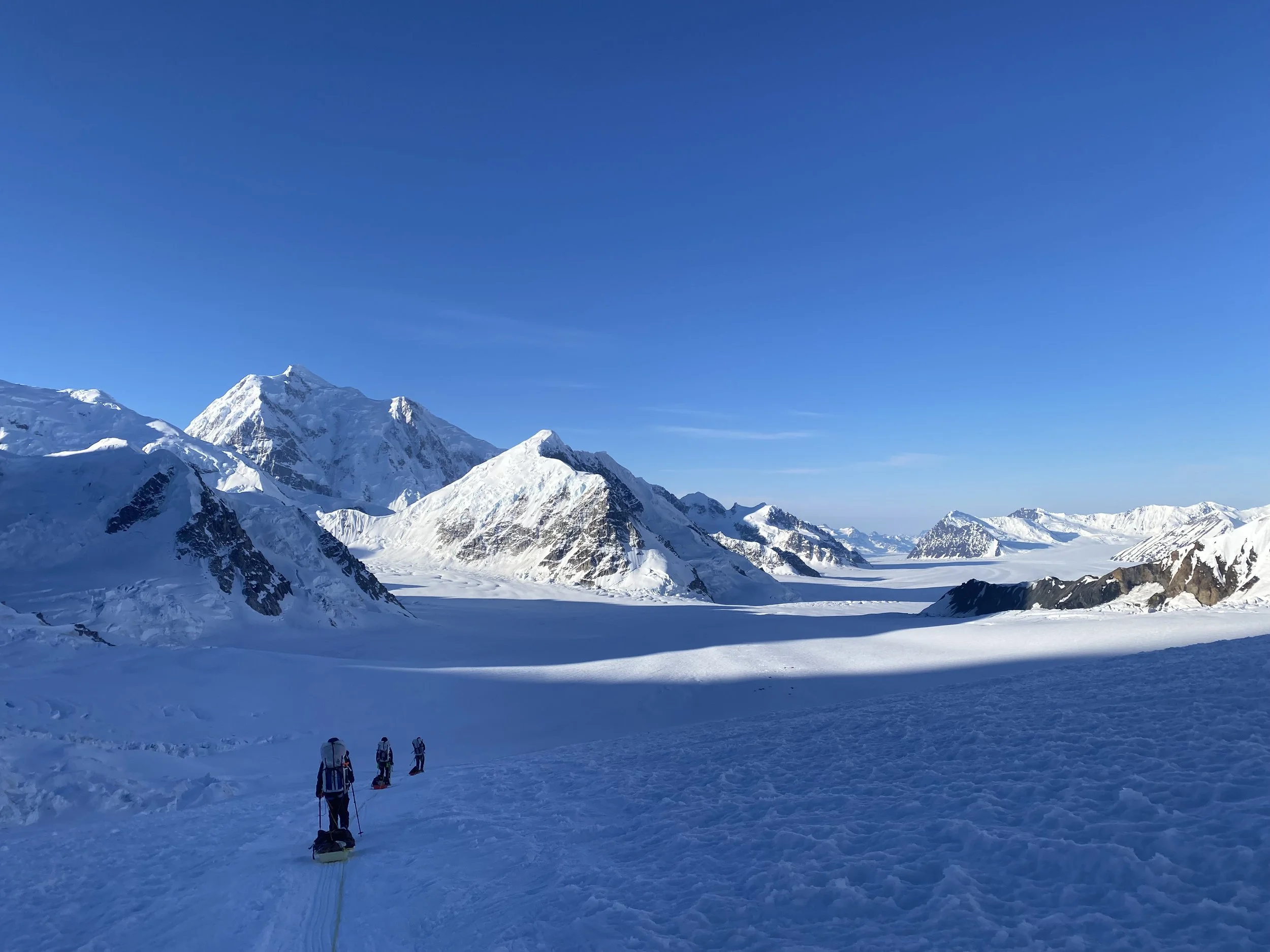
The team descends the West Buttress Route back towards base camp. Begguya is the prominent peak left of center, and base camp is directly underneath the intimidating shaded north face.
Once back to base camp, we began preparing to move up to Begguya for the heart of our season. We had good luck with weather, and the National Park Service flew in on a helicopter the next day to move us and our 1200 lb of food, equipment, and instruments to the Begguya summit plateau at 12,700’. This flight was short, but required almost as much vertical as horizontal movement.
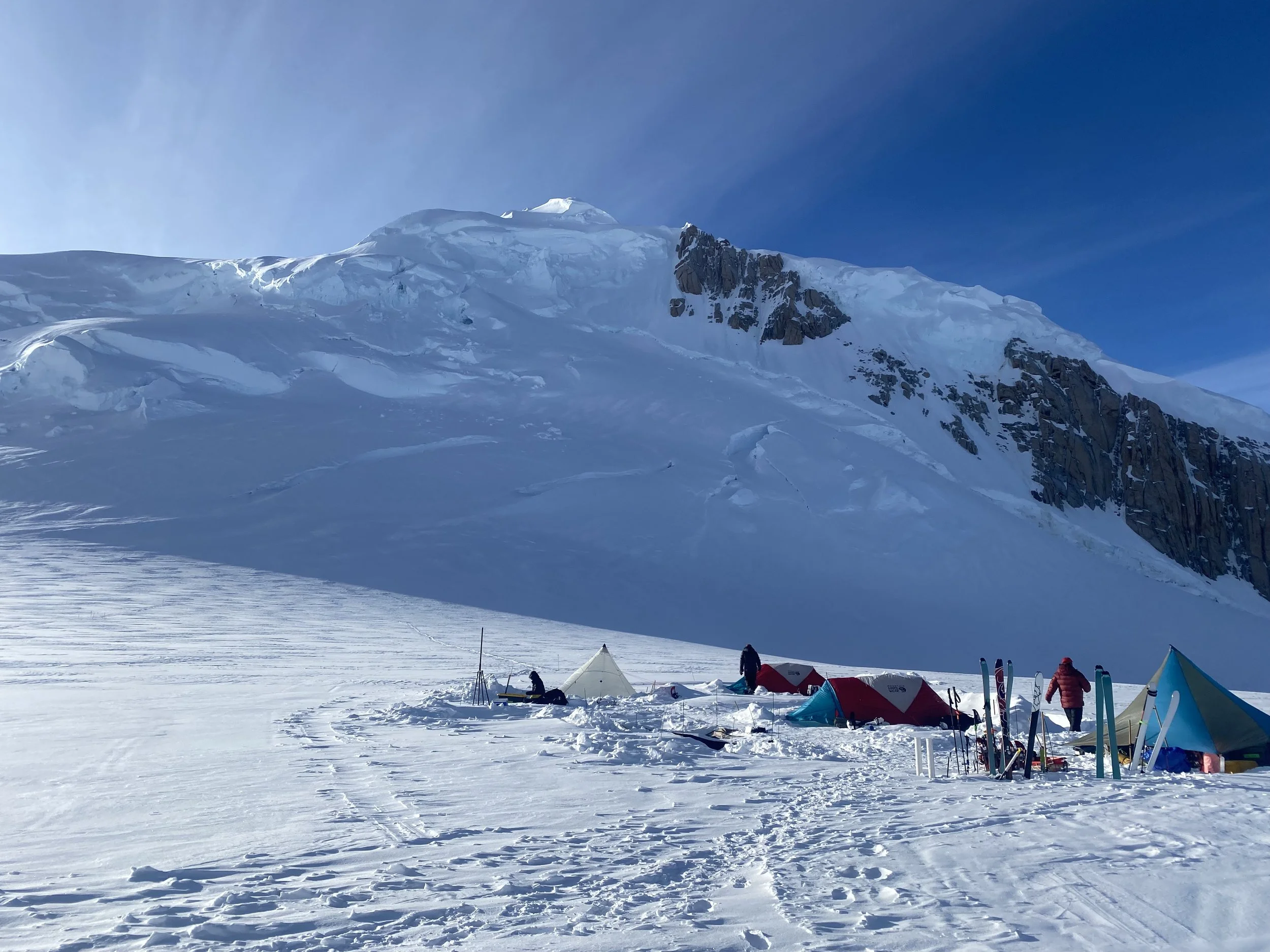
Camp, established on the Begguya summit plateau. The north peak sits behind. Camp includes two sleep tents, a gear tent, and a kitchen. Solar panels charge batteries, and a permanent GPS base station sits left of the kitchen. Wind walls protect camp from the east, but as we learned, storms could come from all directions!
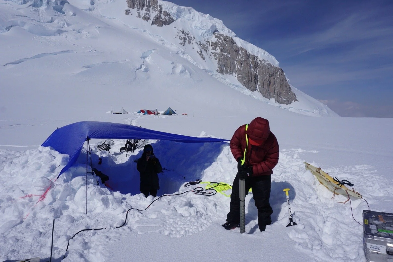
The core of our work on the plateau was geophysics. The summit plateau is roughy one square kilometer, and we broke this into a 50 m x 50 m grid, marked out with bamboo poles. This let us do a highly detailed radar survey. We employed multiple VHF radar systems to studying the upper layers of snow and firn. We could match ice layers in the ice cores to reflectors in these surveys. HF (high frequency) radar surveys let us improve our understanding of bedrock topography and deep ice layers. And phase sensitive aPRES measurements, completed right after we arrived and then again two weeks later, let us watch the depth of internal layers over time and so calculate how quickly the ice is compacting. Note how quick this is - in polar regions it usually takes years, not weeks, to get enough ice movement to watch vertical deformation. However, the snow accumulation in the Alaska range is dramatically higher, measured in meters per year rather than centimeters in polar regions. The results of this survey were some of the most exciting of the summer.
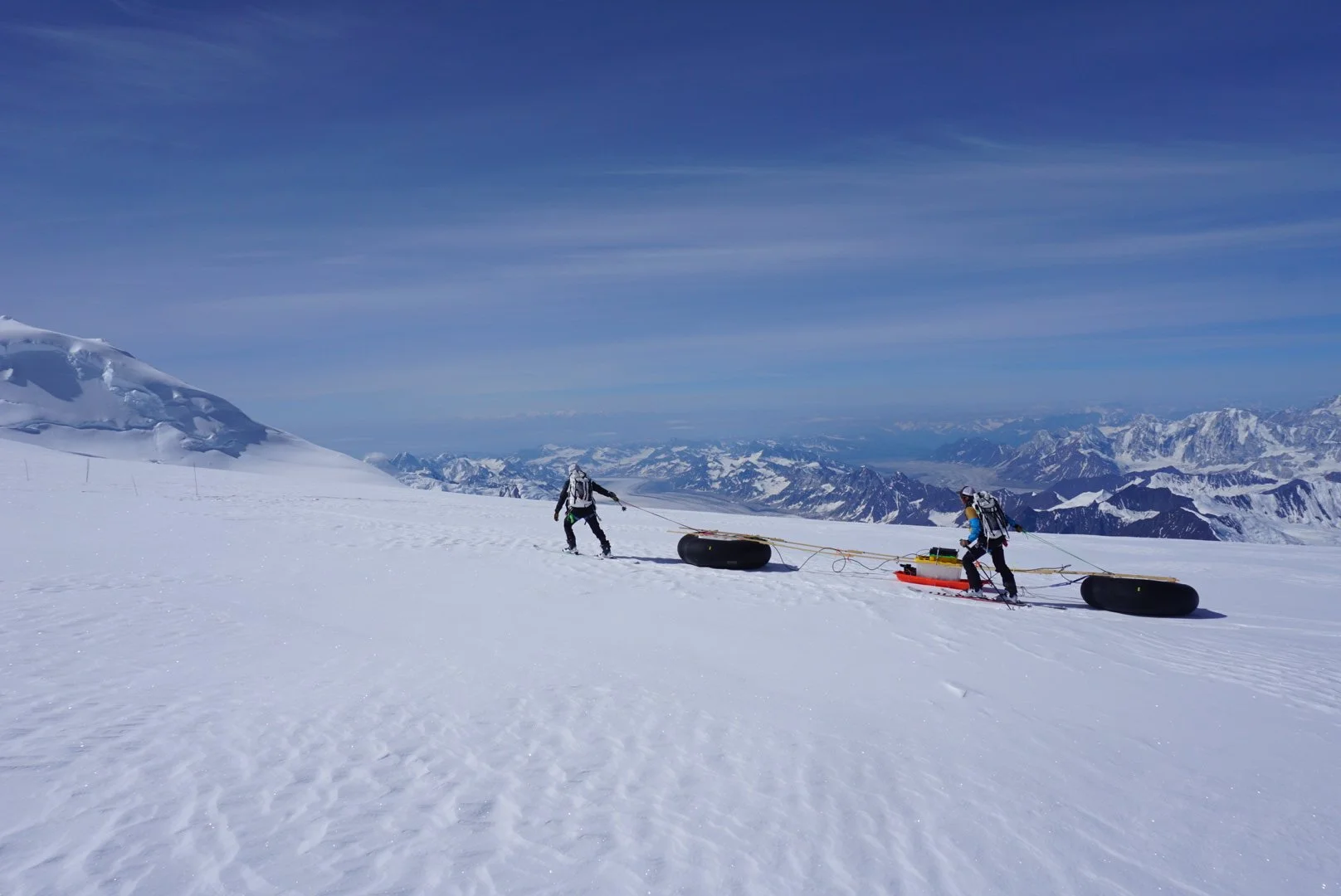
Dragging radar systems around at 12,000’ is hard work! Here two team members deploy an innovative new approach to repeat aPRES radar measurements, with a wood frame ensuring that the two antenna can maintain identical spacing on repeat measurements weeks apart.
While I played a role in deploying the radar systems, my personal goal was to drill a shallow ice core. 20 m of core got us down roughly 5 years, enough to overlap a shallow core drilled in 2019, which in turn overlapped the original 203 m core from 2013. This core brought the record to present. In my proposals to fund this aspect of the project, I discussed how extending the record through to 2022 added significant value to the core. I thought capturing the COVID-19 pandemic was particularly interesting. Recent work with lead isotope measurements allows the identification of lead source regions. I’m excited to see if the ice core record is able to pick up the abrupt changes to global industry through the pandemic - this should be a good test of how our lead pollution proxies preform. I’m also excited to see how the strong 2016 El Nino manifests in sodium and water isotope signals. Even extending the snow accumulation and summer melt records another decade adds major value, as both have seen huge changes over the last decade.
A covered drill tent kept us out of the wind and kept the ice cool durring processing. We used a small 2” stamfli drill powered by solar panels. Living the drill manually was a workout, but helped us save on weight.
In the end, we succeeded in reaching 20 m not once but twice. The first core was packaged in an ice core box, shipped carefully to Dartmouth College, and melted in the Ice, Climate, and Environment Lab. The second core was cut up in the field, with samples taken at ~25 cm resolution for water isotopes. This served a dual purpose. First, this gave us a backup in case the primary core melted (thankfully, it didn’t). Second, it allowed me to isotope melt-caused ice layers, and so see how these melt events impact the ice core record. Early results highlight that these ice layers are isotopically distinct from the ice and snow around them.
After three weeks on Beguyya, we received a pickup from the National Park helicopter, and then a ski plane back to Talkeetna. I immediately set off on my carefully-planned ice core transport plan. The core first rested at a local grocery store (which generously permitted us to use their walk-in freezer), then an Anchorage fish packing facility, before being transported by Alaska Air Cargo, which placed it in a Seattle freezer during it’s layover. Jacob Chalif, lab manager at Dartmouth, carried the ice core on its final leg from the Boston airport to the lab freezer in New Hampshire.
This field season will always have a special place in my heart. I’m still amazed we pulled it off, returning not only safely but also with almost ALL of the data we set out to recover. We did so on a shoestring budget. Applying a very mountaineering style, with ultralight food, kitchen, sleep, and travel systems kept our weight low, minimizing helicopter and ski plane costs. While my future trips might reach more remote locations or colder temperatures, I’ll never be part of an all-student team figuring it out for the first time again.
This season wouldn’t have been possible without financial support from some incredible supporters of student research. I am thankful for funding from the American Alpine Institute, the Dartmouth Dickey Center for International Understanding, the Dartmouth Outing Club, and the Dartmouth Earth Sciences and Environmental Studies departments, which enabled my participation in the field team. We’re also thankful for the support of folks on the ground in Alaska, including Talkeetna Air Taxi and the Denali branch of the National Park Service. Science takes a team!